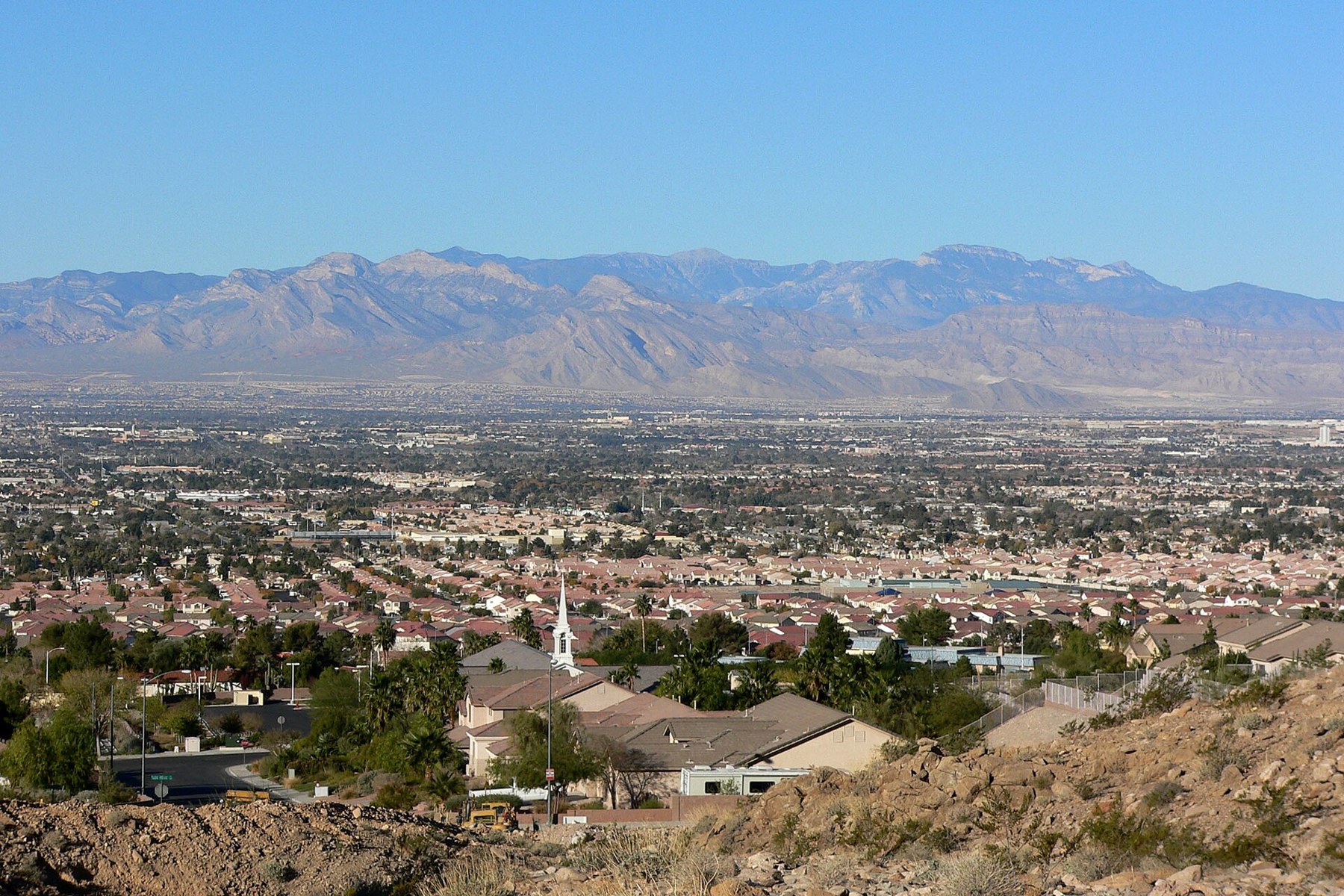
Sunrise Manor source photograph

Outdoors

Wildlife viewing and birding near Sunrise Manor

Refuges, lakes and wild areas near Sunrise Manor for wildlife viewing and birdwatching.

21places to see wildlife
20 mito the closest
5within 30 miles

Good to know: Early mornings and evenings are best for wildlife; bring binoculars and keep a respectful distance.

Closest picks

1

Hoover Dam

20 mi southeast · Bureau of Reclamation

Hoover Dam on the Colorado River, is a feature of the Boulder Canyon Project . Located on the Arizona-Nevada state line, at 726 feet it is the highest concrete dam in the United States, a National Historic Landmark, and one of America's…
2

Red Rock Canyon Campground

20 mi west · Bureau of Land Management

Red Rock Canyon's standard, RV, and group campsites are located in the stunning Red Rock Canyon National Conservation Area, an approximate 20 mile drive from "The Las Vegas Strip." Visitors enjoy hiking, rock climbing, bike riding and…

3

Red Rock Canyon National Conservation Area

23 mi west · Bureau of Land Management

Visit the red- and cream-colored sandstone cliffs and experience the natural wonders of the Mohave Desert just 17 miles west of the Las Vegas Strip.

Map of all 21 places

Map of 21 places loads as you scroll.

Within 30 miles (5)

20 mi southeast · Bureau of Reclamation

Hoover Dam

Hoover Dam on the Colorado River, is a feature of the Boulder Canyon Project . Located on the Arizona-Nevada state line, at 726 feet it is the highest concrete dam in the United States, a National Historic Landmark, and one of America's…

  • Biking
  • Boating
  • Hiking
  • History
  • Nature education
  • Ranger programs
  • Wildlife viewing

20 mi west · Bureau of Land Management · Campground

Red Rock Canyon Campground

Red Rock Canyon's standard, RV, and group campsites are located in the stunning Red Rock Canyon National Conservation Area, an approximate 20 mile drive from "The Las Vegas Strip." Visitors enjoy hiking, rock climbing, bike riding and…

  • Biking
  • Camping
  • Hiking
  • History
  • Horseback riding
  • Ranger programs
  • Rock Climbing
  • Wildlife viewing

23 mi west · Bureau of Land Management

Red Rock Canyon National Conservation Area

Visit the red- and cream-colored sandstone cliffs and experience the natural wonders of the Mohave Desert just 17 miles west of the Las Vegas Strip.

  • Biking
  • Hiking
  • History
  • Picnicking
  • Ranger programs
  • Wildlife viewing

25 mi northwest · Fish and Wildlife Service

Desert National Wildlife Refuge

Encompassing six major mountain ranges and seven distinct life zones , Desert NWR showcases the abundance and variety of nature that can be found in Southern Nevada, all just a short drive from Las Vegas.

  • Backpacking
  • Biking
  • Birding
  • Camping
  • Educational Programs
  • Hiking
  • Horseback riding
  • Hunting

29 mi southeast · Bureau of Land Management

Mount Wilson Wilderness

The 23,900-acre Mount Wilson Wilderness Area is located in Mohave County, Arizona, approximately 30 miles southeast of Las Vegas, Nevada, and 60 miles northwest of Kingman, Arizona.

  • Backpacking
  • Dispersed Camping
  • Hiking
  • Wilderness
  • Wildlife viewing

30 to 75 miles (14)

33 mi west · USDA Forest Service · Campground

Fletcher View

Fletcher View Campground is set in the beautiful Spring Mountains National Recreation Area, just 24 miles from Las Vegas. Visitors enjoy hiking, horseback riding and scenic driving in this forested desert oasis.

  • Biking
  • Camping
  • Hiking
  • Wildlife viewing

33 mi west · USDA Forest Service · Campground

Kyle Canyon Picnic Area Day Use

Kyle Canyon Picnic Area is set in the beautiful Spring Mountains National Recreation Area, just 23 miles from Las Vegas. Visitors enjoy hiking, horseback riding and scenic driving in this forested desert oasis.

  • Camping
  • Hiking
  • Picnicking
  • Wildlife viewing

37 mi west · USDA Forest Service · Campground

Foxtail Grp Picnic Area

Foxtail Group Picnic Area is located in the Spring Mountains National Recreation Area, just 47 miles from downtown Las Vegas. Visitors enjoy hiking, mountain biking, scenic driving, and winter snowplay in this forested desert oasis.

  • Biking
  • Birding
  • Camping
  • Hiking

38 mi south · Bureau of Land Management

Highland Range Crucial Bighorn Habitat

The area was set aside for the protection and propagation of desert bighorn sheep. No public access. US 95 runs along the eastern flank of the area.

  • Wildlife viewing

41 mi east · National Park Service

Lake Mead National Recreation Area

Experience outdoor thrills, striking landscapes, and brilliant blue waters. This year-round recreation area spreads across 1.5 million acres of mountains, canyons, valleys and two vast reservoirs.

  • Biking
  • Boating
  • Camping
  • Diving
  • Fishing
  • Hiking
  • Horse Camping
  • Horseback riding

50 mi southwest · Bureau of Land Management

Mesquite Wilderness

The Mesquite Wilderness consists of portions of the Mesquite Mountains, Mesquite Valley, and the Clark Mountain Range. Numerous small caves are found in the porous rock of the Clark Mountains.

  • Camping
  • Hiking
  • Horseback riding
  • Hunting
  • Photography
  • Wildlife viewing

50 mi southwest · Bureau of Land Management

Pahrump Valley Wilderness

The Pahrump Valley in the north, the Mesquite Valley in the southeast, and the California Valley in the west join forces in this desolate, seldom-visited Wilderness.

  • Camping
  • Hiking
  • Horseback riding
  • Hunting
  • Nature education
  • Photography
  • Ranger programs
  • Wilderness

53 mi southwest · Bureau of Land Management

North Mesquite Mountains Wilderness

The North Mesquite Mountains Wilderness consists of the broad western end of Sandy Valley and the northern portion of Mesquite Mountains.

  • Camping
  • Hiking
  • Horseback riding
  • Hunting
  • Photography
  • Wildlife viewing

56 mi southwest · Bureau of Land Management

Clark Mountain Camp

Clark Mountain Camp is located on the southern end of the Clark Mountain Range. It is also within the Clark Mountain Area of Critical Environmental Concern (ACEC).

  • Biking
  • Camping
  • Hiking
  • Horseback riding
  • Hunting
  • Photography
  • Wildlife viewing

56 mi southwest · Bureau of Land Management

Horsethief Springs/Cabin

Horsethief Springs offers excellent bird and wildlife viewing. This perennial spring provides life giving water for resident wildlife and migrating birds alike. Wildlife viewing is best during early morning and evening hours.

  • Camping
  • Hiking
  • Hunting
  • Nature education
  • Photography
  • Wildlife viewing

59 mi northeast · Bureau of Land Management

Gold Butte Back Country Byway

One of the first designated backcountry byways, the Gold Butte Back Country Byway travels through some of the most remote landscapes of southern Nevada.

  • Camping
  • Horseback riding
  • Off-highway vehicles
  • Photography
  • Scenic Drive
  • Wildlife viewing

68 mi west · Bureau of Land Management

Resting Spring Range Wilderness

Hunting, fishing, and non-commercial trapping are allowed under state and local laws.Pet are allowed, but please keep your pets under control at all times.Horses are permitted, however you may be required to carry feed.

  • Camping
  • Hiking
  • Horseback riding
  • Hunting
  • Nature education
  • Photography
  • Ranger programs
  • Wilderness

71 mi southeast · Bureau of Land Management · Campground

Windy Point Campground

Located on the crest of the Cerbat Mountains, Windy Point Campground provides visitors scenic views of the surrounding valley and distant mountain ranges.

  • Bird Watching
  • Camping
  • Camping Area
  • Wildlife viewing

71 mi southeast · Bureau of Land Management

Windy Point Recreation Site

Windy Point Recreation Site is located along the crest of the Cerbat Mountains, high above the old mining town of Chloride, Arizona.

  • Bird Watching
  • Birding
  • Camping
  • Hiking
  • Hunting
  • Picnicking
  • Wildlife viewing

75 miles and farther (2)

101 mi southeast · Bureau of Land Management · Campground

Wild Cow Springs Campground

Wild Cow Springs Campground is situated in a grove of oak and large ponderosa pines within the Hualapai Mountains, at an elevation of 6,200 ft.

  • Camping
  • Hiking
  • Hunting
  • Picnicking
  • Wildlife viewing

101 mi southeast · Bureau of Land Management · Campground

Wild Cow Springs Campground

Wild Cow Springs Campground is situated in a grove of oak and large ponderosa pines within the Hualapai Mountains, at an elevation of 6,200 feet.

  • Accessible Facility Or Activity
  • Camping
  • Camping Area
  • Hiking
  • Picnicking
  • Wildlife viewing

Distances are straight-line miles from downtown Sunrise Manor. Listings come from Recreation.gov’s federal recreation database; check each official page for hours, fees, fire restrictions and closures before you go.

Get outside around Sunrise Manor

Hollywood Park Sunrise Manor East Las Vegas Nevada. video thumbnail

THINGS TO DO · YOUTUBE SHORT

Hollywood Park Sunrise Manor East Las Vegas Nevada.

A local activity video shared by Mark Magill.

Watch on YouTube ↗
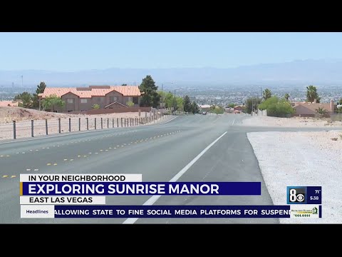
In Your Neighborhood: Sunrise Manor offers established, diverse community video thumbnail

THINGS TO DO · YOUTUBE SHORT

In Your Neighborhood: Sunrise Manor offers established, diverse community

A local activity video shared by 8 News Now — Las Vegas.

Watch on YouTube ↗

Around Sunrise Manor

Textures, Sunrise Manor
Textureskeith schurr from Las Vegas, Nv., U.S.A. · CC BY-SA 2.0
Las Vegas, Nevada East of Boulder Strip, Sunrise Manor
Las Vegas, Nevada East of Boulder StripKen Lund from Reno, Nevada, USA · CC BY-SA 2.0
View west along Nevada State Route 147 (Lake Mead Boulevard) near Easement Lane in Sunrise Manor, Nevada
2015-11-04 12 32 24 View west along Nevada State Route 147 (Lake Mead Boulevard) near Easement Lane in Sunrise Manor, NevadaFamartin · CC BY-SA 4.0

More outdoors near Sunrise Manor

Questions

Where is the closest place for wildlife & birding near Sunrise Manor?

Hoover Dam (Bureau of Reclamation), about 20 miles southeast of Sunrise Manor as the crow flies. Next are Red Rock Canyon Campground (20 mi) and Red Rock Canyon National Conservation Area (23 mi).

Who manages these places?

Federal agencies including Bureau of Land Management, USDA Forest Service, Bureau of Reclamation. Each listing links to its official page for hours, fees, closures and current conditions.

Sunrise Manor AI

Your Sunrise Manor local guide
Hey there!

I'm Sunrise Manor AI. Ask about neighborhood food, independent shops, local history or planning a visit.

AI recommendations may be inaccurate. Verify hours and prices. Questions are processed by Cloudflare. Privacy